Last week I wrote about making a screencast to capture information about the MacArthur Maze detour for possible use offline. This week I’m in a similar situation. I’m scouting out places to go in Wellington, and elsewhere in New Zealond, and of course I’m doing that online. But I’ll probably be needing to refer to this research while I’m offline, so I’m annotating maps with that purpose in mind.
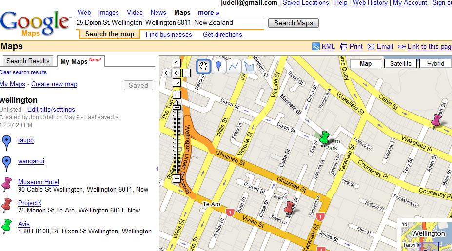
From that perspective, I’ve noticed some subtle differences between maps.google.com and maps.live.com. (maps.yahoo.com doesn’t seem to cover this part of the world.) In both cases, you can search for an address, add it to a saved map as a pushpin which includes the address you searched for, and then edit the blurb that appears with the pushpin. So, for example, I was able to change “25 Dixon Street” to the more useful “Avis, 4-801-8108, 25 Dixon Street.”
One subtle difference is that in Google Maps, the pushpins you add to your saved map all default to the same color. If you’ll be referring to a cached image, there’s no way to correlate between the legend and the locations on the map. To enable that, I had to edit each pushpin and vary its color.
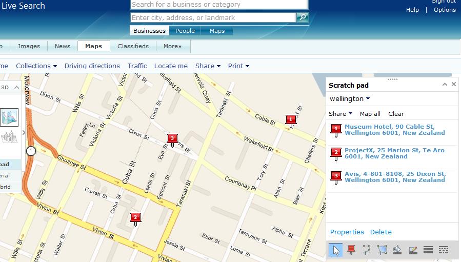
In the Live Search product, by contrast, the pushpins are numbered which means there’s no extra step required to correlate between the legend and the locations. That makes it slightly easier to create something that’s useful in print — or, since printers are often hard to find when traveling, that’s useful as a saved image.
Another subtle difference is that in the Google case, varying the colors of your saved pushpins might not help if you send the map to a black-and-white printer.
I’d be curious to know to what extent these differences represent a conscious strategy on the part of the Live team to make annotated maps more useful offline. I’m also really interested in ways that a subset of the interactivity of online maps can be captured for offline use. The screencast I made last week was a crude step in that direction, there’s lots more that could be done.
Perhaps you find http://quikmaps.com/new relevant in this context.
Peter
Re: color, not to mention that in the case where numbers are used, this helps people who are colorblind. The organization I work for adheres to Section 508 requirements for the product I work on, which I personally find useful to review if nothing else, for the general usability suggestions (like not indicating textual differences with color alone).
Jon, you may also find the local http://zoomin.co.nz/ maps useful for your trip.